Ragasa’s Arrival and the Immediate Response in Hong Kong
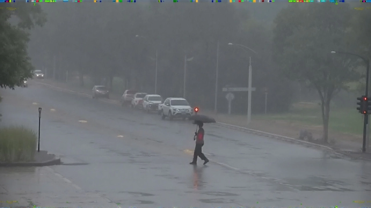
By the time the evening of September 23 rolls around, Hong Kong will be under the shadow of Super Typhoon Ragasa, a storm that meteorologists are calling the strongest tropical cyclone to hit the region in years. Wind speeds are projected to peak at 220 km/h, a force capable of ripping roofs off houses and turning everyday objects into dangerous projectiles.
The Hong Kong Observatory has already pushed the Tropical Cyclone Warning Signal to T8, the third‑highest level in its system. Forecast teams are watching the storm’s trajectory closely, ready to upgrade to the rare T10 signal if the winds intensify further after 11:00 PM. This proactive stance mirrors the city’s “better safe than sorry” philosophy that took shape after past typhoons caused unexpected damage.
Transportation has been hit hard. Hundreds of flights scheduled to depart from the airport have been cancelled through Thursday, effectively bringing air travel to a halt. The MTR (Mass Transit Railway) has announced a suspension of most services, while ferry routes across Victoria Harbour are also on hold. Drivers have been instructed to avoid the roads unless absolutely necessary, and police are patrolling major thoroughfares to keep traffic to a minimum.
Schools across the territory are closed for the duration of the storm, and most offices have ordered staff to work from home or stay put. The government has set up emergency shelters in community centers and sports complexes, especially in low‑lying districts where the risk of flooding is highest.
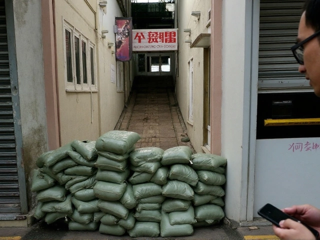
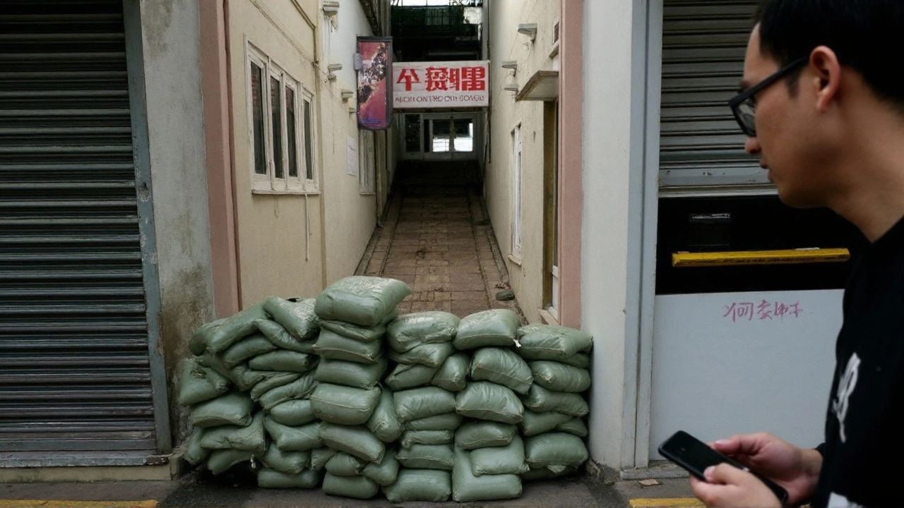
- Windows and glass doors are being taped shut or boarded up by residents.
- Supermarkets report a surge in purchases of bottled water, non‑perishable food, and batteries.
- Emergency kits, including first‑aid supplies and flashlights, are being distributed by district councils.
Authorities are urging everyone to stay indoors until the storm passes, emphasizing the danger posed by flying debris. The public broadcasting service continuously loops safety reminders, and social media channels are flooded with real‑time updates from the Observatory.
Regional Impact: From the Philippines to Vietnam
Ragasa didn’t start its destructive trek in Hong Kong. The system first made landfall in the Philippines on Monday, smacking the country’s northern provinces and forcing thousands to evacuate. In the Philippines, power lines were toppled, rice paddies flooded, and dozens of families lost their homes. The damage assessment there is still ongoing, with local officials estimating millions of dollars in losses.
Now the storm is pushing westward toward China’s Pearl River Delta. In Guangdong province, officials have evacuated more than 370,000 residents from flood‑prone zones. Shenzhen, a megacity just across the border from Hong Kong, has issued its highest‑level alert, mobilizing police, fire services, and the military to enforce evacuation orders and assist with sandbagging operations along the coastline.
Beijing’s meteorological administration has taken the unusual step of calling Ragasa the "King of Storms," a phrase that underscores both its sheer power and the rarity of such an event in the region. Experts say the typhoon could outdo every other system that has struck Guangdong this year, delivering not only ferocious winds but also torrential rain that could trigger flash floods and landslides in the mountainous hinterland.
Beyond China, the storm’s projected path points toward northern Vietnam. Models show Ragasa maintaining enough moisture to dump heavy rainfall across the Red River Delta, a region already vulnerable to seasonal flooding. If the storm retains even a fraction of its intensity, millions could face evacuation orders, power outages, and disrupted food supplies.
Regional disaster‑response agencies are coordinating through the ASEAN emergency network, sharing satellite images, weather models, and rescue resources. Vietnam’s central command has already pre‑positioned relief materials and is briefing local authorities on evacuation routes.
While Ragasa is expected to weaken as it traverses land, the sheer volume of water it carries means the threat of secondary hazards—like landslides, storm‑surge flooding, and prolonged water‑logging—remains high. Emergency managers in all affected countries stress the importance of staying informed, securing property, and following official evacuation directives.
In Hong Kong, the city’s emergency operations centre continues to monitor the storm’s evolution minute by minute. Even after the winds subside, clean‑up crews will face a massive task restoring power, clearing debris, and assessing structural damage across the densely populated urban landscape. The resilience of the city will be tested, but the coordinated response so far suggests a determined effort to minimize loss of life and keep the economy moving once the clouds finally lift.